Property Record
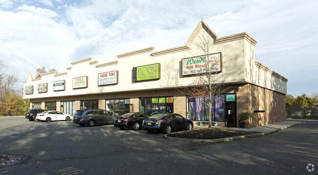
745 Route 9 Blvd, Berkeley, NJ 08721


Property Detail
745 Route 9 Blvd
06-01407-0000-00011-22
2.25 AC
Commercialnec
OCEAN
HB
New Jersey
B and X Area of moderate flood hazard, usually the area between the limits of the 100-year and 500-year floods.
11.22
2025
2.25 AC
2025
Ocean County
731002
Northern New Jersey
7,350 SF
Lakewood-New Brunswick, NJ
NEARBY LISTINGS FOR SALE OR LEASE
DEMOGRAPHICS near 745 Route 9 Blvd
1 mile
3 mile
5 mile
2025 Total Population
5,343
36,676
93,642
2030 Population
5,440
37,619
96,518
Pop Growth 2025-2030
+ 1.82%
+ 2.57%
+ 3.07%
Average Age
38
40
41
2025 Total Households
1,700
13,165
34,636
HH Growth 2025-2030
+ 1.24%
+ 2.07%
+ 2.85%
Median Household Inc
$115,295
$104,814
$99,222
Avg Household Size
2.90
2.70
2.60
2025 Avg HH Vehicles
2.00
2.00
2.00
Median Home Value
$392,336
$386,860
$388,921
Median Year Built
1991
1982
1977
Nearby Places
Map Layers
Map Styles
 Street
 Aerial
Transit
 Traffic
 Biking
Places
Listings with unknown addresses are not visible on the map
- Restaurants
- Banks
- Shops
- Fitness
- Groceries
PUBLIC TRANSPORTATION
AIRPORT
Atlantic City International
Drive
Walk
Distance
Atlantic City International
78 min
45.7 mi
Nearby Properties
Address
Land Use
TOTAL SIZE
Lot Size
Zoning
Address
Land Use
TOTAL SIZE
Lot Size
Zoning
35,102 SF
139.33 AC
LI
Address
Land Use
TOTAL SIZE
Lot Size
Zoning
96.60 AC
R100
Address
Land Use
TOTAL SIZE
Lot Size
Zoning
2,000 SF
94 AC
CR
Address
Land Use
TOTAL SIZE
Lot Size
Zoning
15.67 AC
RC
Address
Land Use
TOTAL SIZE
Lot Size
Zoning
8,968 SF
26.36 AC
RMF
Address
Land Use
TOTAL SIZE
Lot Size
Zoning
72.26 AC
R100
Address
Land Use
TOTAL SIZE
Lot Size
Zoning
2,549 SF
16.02 AC
RC
Address
Land Use
TOTAL SIZE
Lot Size
Zoning
1,494 SF
17.30 AC
R200
Address
Land Use
TOTAL SIZE
Lot Size
Zoning
1,680 SF
14.33 AC
HB
Address
Land Use
TOTAL SIZE
Lot Size
Zoning
142,047 SF
18.72 AC
C150
Address
Land Use
TOTAL SIZE
Lot Size
Zoning
22.29 AC
HB
Address
Land Use
TOTAL SIZE
Lot Size
Zoning
4,102 SF
8 AC
HB
Address
Land Use
TOTAL SIZE
Lot Size
Zoning
3,000 SF
10.77 AC
HB
Address
Land Use
TOTAL SIZE
Lot Size
Zoning
2,792 SF
13.72 AC
R100
Address
Land Use
TOTAL SIZE
Lot Size
Zoning
5,364 SF
16.30 AC
R125
Address
Land Use
TOTAL SIZE
Lot Size
Zoning
28.80 AC
R100
Address
Land Use
TOTAL SIZE
Lot Size
Zoning
1,740 SF
38.81 AC
HB
Address
Land Use
TOTAL SIZE
Lot Size
Zoning
69,798 SF
6.92 AC
R200
Address
Land Use
TOTAL SIZE
Lot Size
Zoning
6.14 AC
C150
Address
Land Use
TOTAL SIZE
Lot Size
Zoning
559.95 AC
GI
Address
Land Use
TOTAL SIZE
Lot Size
Zoning
79,200 SF
8.93 AC
RMF
Address
Land Use
TOTAL SIZE
Lot Size
Zoning
47,440 SF
6.09 AC
R150
Address
Land Use
TOTAL SIZE
Lot Size
Zoning
1.24 AC
R
Address
Land Use
TOTAL SIZE
Lot Size
Zoning
2,896 SF
25 AC
R200
Address
Land Use
TOTAL SIZE
Lot Size
Zoning
8.71 AC
HB
Address
Land Use
TOTAL SIZE
Lot Size
Zoning
6.26 AC
RMF
Address
Land Use
TOTAL SIZE
Lot Size
Zoning
11,597 SF
2.76 AC
C
Address
Land Use
TOTAL SIZE
Lot Size
Zoning
102.71 AC
HB
Address
Land Use
TOTAL SIZE
Lot Size
Zoning
80,700 SF
4.12 AC
HB
Address
Land Use
TOTAL SIZE
Lot Size
Zoning
3,840 SF
244.21 AC
CR
The World's #1 Commercial Real Estate Marketplace
Connect with us
© 2026 CoStar Group
The information above has been obtained from sources believed reliable. While we do not doubt its accuracy we have not verified it and make no guarantee, warranty or representation about it. It is your responsibility to independently confirm its accuracy and completeness. Any projections, opinions, assumptions, or estimates used are for example only and do not represent the current or future performance of the property. The value of this transaction to you depends on tax and other factors which should be evaluated by your tax, financial, and legal advisors. You and your advisors should conduct a careful, independent investigation of the property to determine to your satisfaction the suitability of the property for your needs.